360 degree Panoramas + Google Maps
- Mar 26, 2010 modified: Feb, 04 2025
360 degree Panoramas + Google Maps
We have some very interesting projects that integrate Google Maps with panoramic images.
They can also be combined into full virtual tours.
We have created Virtual Tours and information sites including one project for the Marine Discovery Centre Virtual Tour that also includes interactive Google Maps and our Content Management System. (this news and video system is part of our CMS)
It includes original sound tracks including panoramics for each location.
One area is VR and panoramic images - perfect for a real-estate site.
This is a cost effective way to display panoramas without the high cost of a professional photographer.
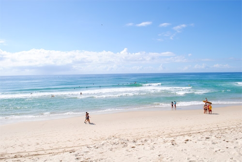
Click the video icon to see the example shot 200 metres from my office at Main Beach (another good reason to update your site). Use your mouse to guide the panorama.
This is shot using a good quality tripod and a Nikon SLR digital camera.
We love new and challenging projects - check more of our latest web projects.
First launched 26 March 2010.
Using Panoramic Images to Monitor Erosion
At Save Our Spit we have a page that monitors erosion. It includes some useful panoramic images to give a real comparison of sand dunes before cement paths were added to the foredunes.
Search News Articles...
Recent Articles

Public Service Cuts
- Mar 11 2025
- /
- 95

Using QR codes for your business
- Feb 24 2025
- /
- 160

What is the Network Effect?
- Feb 05 2025
- /
- 207

Connecting Communities on Twitter X
- Jan 20 2025
- /
- 283

Parasite SEO: the consequences
- Jan 06 2025
- /
- 347

Identifying Misinformation Online
- Dec 20 2024
- /
- 420

How is Metadata used in SEO?
- Nov 21 2024
- /
- 360

Amazon's Role in E-Commerce
- Nov 05 2024
- /
- 334

Australia's Energy Future
- Oct 31 2024
- /
- 562

The benefits of Artificial Intelligence
- Sep 03 2024
- /
- 621
View All News Articles
Categories
A Gold Coast SEO and Web Developer